Mouse Hole to Beer Garden
More thinking through pictures this week. Next summer, provided John is happy for us to carry on digging up his pasture, then we are going to try to excavate some of the innner ditch segments and interior of the Whitewell Enclosure. In an attempt to still keep some kind of focus on the wider study area I’ve decided that it would also be good to do some targeted areas of gradiometer survey in the spring. There are two areas in particular that I want to look at. Trying to locate these surveys has brought me back to working on the landscape zones that I set up last spring.
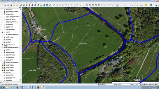
To re-cap, these are supposed to be parts of the study area which have similar physical characteristics. If we sample an equal amount of each of these zones then we should be evenly covering the whole study area. This is the flat land enclosed by the bend in the Hodder opposite the Inn at Whitewell. As you can see from the screen grab I have also got on with the essential task of thinking up whimsical shipping forecast style names for these territories. This is Beer Garden because you can see it from the pub. I want to survey here because I think that there will be a thick layer of river silt over any prehistoric archaeology. This will make it harder to get at but should ensure that it is well-preserved.
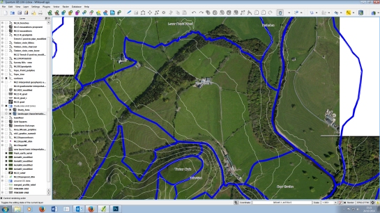
To the north-west of Beer Garden is Reed Barn (named after the farm smack bang in the middle of it). This is at a slightly higher elevation and isn’t as flat but there should still be lots of river silt here too. Mike did his master’s dissertation looking at how investigate precisely this kind of landscape in the Ribble Valley, so I’m hoping we can apply some of his methodologies here.
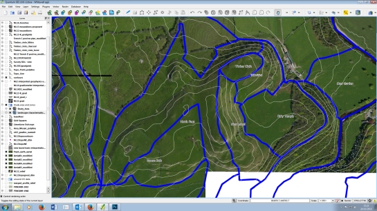
To the west of the zones where we have already done lots of work there is another flat(tish) bit of land. This is the area which included Mouse Hole, one of the caves we dug in 2011, but the whole flat plateau behind is covered in dolines. Geophysics here might tell us quite a lot about how the cave systems work but also, hopefully, reveal other unknown archaeology. The other thing you can see in this image is how we have parcelled out the rest of New Laund Hill. By a process of contraction, the plateau that includes Fairy Holes, the Whitewell Enclosure and Temple Cave has become the Arthur Rackhamesque Fairy Temple. To the north of that is Television. This is not me coming over all New Wave. Apart from sheep there are two obvious features in this zone, one is a big lime quarry (and you find them all over the study area) and the other is the TV mast that means the farm has any terrestrial reception at all. Above that is Timber Circle, because there is one there. Beyond Timber Circle the hill falls off down to the valley floor. This zone is all steep and north-facing, hence North Face. This has left us with a long thin, east facing buffer state between the rest which I have imaginatively called New Laund.
Rick


Pingback: Around the Archaeology Blog-o-sphere Digest #8 | Doug's Archaeology