Archive

Tag Archives: landscape archaeology

Scott and James have started work today on what should be about a week’s gradiometer survey in the landscapes around New Laund Hill. The plan is for them to survey large chunks of the different slopes and elevations. This is hopefully going to provide them both with MSci dissertation topics as they investigate the prehistoric landscape around the known archaeology we have been excavating for the last few years.

IMAG0653

They started down by the river, on the alluvial floodplain opposite the Inn at Whitewell. We’d chosen to do the survey this week because 1) all this year’s assessments are now finished (they are nearly all marked too) so we should all have a bit more time for research and 2) its bound to be sunny on the 1st of June isn’t it? This is the view down from New Laund farm towards the river plain, the small wet dots trudging backwards and forwards are James and Scott.

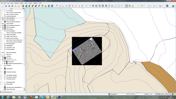
While they were doing the actual gradiometer work Clare and I were running around the farm ahead of them with the total station fixing the position of the survey onto the OS national grid. I’ve explained how the gradiometer works, to the best of my ability, before. As well as detecting the buried archaeology, we also need to be able to locate it on our maps of the area. The easiest way to do this is to make sure that the 30 x 30 m areas we survey have whole number national grid co-ordinates at the corners.

IMAG0656

The weather was actually less miserable than forecast yesterday. It stayed dry until about 1.00 and the gales and heavy rain that Scott is battling into here only turned up about 3.00. Clare and I had it relatively lucky. We didn’t need to be non-magnetic to do our part of the job and so could wear proper waterproofs and boots.

Survey continues tomorrow – yellow warning of wind say the Met Office – and Dan, Mairead and I will also be sampling for pollen further up the hill as part of Dan’s MSci dissertation. Wildlife of the day was curlews, they whizz about the lower meadows on the farm in stupendous numbers, which kept almost crashing into Clare and I as we worked.

Rick

More thinking through pictures this week. Next summer, provided John is happy for us to carry on digging up his pasture, then we are going to try to excavate some of the innner ditch segments and interior of the Whitewell Enclosure. In an attempt to still keep some kind of focus on the wider study area I’ve decided that it would also be good to do some targeted areas of gradiometer survey in the spring. There are two areas in particular that I want to look at. Trying to locate these surveys has brought me back to working on the landscape zones that I set up last spring.

Beer garden

To re-cap, these are supposed to be parts of the study area which have similar physical characteristics. If we sample an equal amount of each of these zones then we should be evenly covering the whole study area. This is the flat land enclosed by the bend in the Hodder opposite the Inn at Whitewell. As you can see from the screen grab I have also got on with the essential task of thinking up whimsical shipping forecast style names for these territories. This is Beer Garden because you can see it from the pub. I want to survey here because I think that there will be a thick layer of river silt over any prehistoric archaeology. This will make it harder to get at but should ensure that it is well-preserved.

Reed Barn

To the north-west of Beer Garden is Reed Barn (named after the farm smack bang in the middle of it). This is at a slightly higher elevation and isn’t as flat but there should still be lots of river silt here too. Mike did his master’s dissertation looking at how investigate precisely this kind of landscape in the Ribble Valley, so I’m hoping we can apply some of his methodologies here.

Mouse Hole

To the west of the zones where we have already done lots of work there is another flat(tish) bit of land. This is the area which included Mouse Hole, one of the caves we dug in 2011, but the whole flat plateau behind is covered in dolines. Geophysics here might tell us quite a lot about how the cave systems work but also, hopefully, reveal other unknown archaeology. The other thing you can see in this image is how we have parcelled out the rest of New Laund Hill. By a process of contraction, the plateau that includes Fairy Holes, the Whitewell Enclosure and Temple Cave has become the Arthur Rackhamesque Fairy Temple. To the north of that is Television. This is not me coming over all New Wave. Apart from sheep there are two obvious features in this zone, one is a big lime quarry (and you find them all over the study area) and the other is the TV mast that means the farm has any terrestrial reception at all. Above that is Timber Circle, because there is one there. Beyond Timber Circle the hill falls off down to the valley floor. This zone is all steep and north-facing, hence North Face. This has left us with a long thin, east facing buffer state between the rest which I have imaginatively called New Laund.

Rick

Is the light of the on-coming field season. Only two weeks to go now before we start digging again. On Friday we held our final exam board of the academic year. This marks the unofficial end of the academic year, leaving me free to concentrate more or less full-time on excavation planning. Duncan, of course, is already fully involved in digging. Oakington Anglo-Saxon excavations have been running for a week now. It looks as if they’ve had a good start (I know everything always looks positive on Facebook but I’ve also had a sneak preview via Skype, they look to have a lot of pottery – don’t ask about the hula skirts).

Aside from all the ‘have we got enough clipboards?’/’where are all the line levels?’ type questions you have to ask before you go digging I have been attempting to build on the landscape characterisation I did a few weeks ago. I still haven’t thought up names for any of the areas but I have been thinking about how much data we need from each zone before we can say that we know enough.

zone1 screenshotIn the centre of this GIS plot is the zone around the area we will be digging this summer. As you can see it also includes Fairy Holes cave and Temple Cave (which we dug in 2011). By the time we have finished this summer we should have good pollen sequences from three or four locations across the landscape, a range of Neolithic and Early Bronze Age evidence from our excavations at Fairy Holes, trench K and, hopefully, the new digs. We have the geophysics Mike, Scott and James did last summer but it would be good to have another chunk of the zone surveyed with the gradiometer. We should be able to get everything we want from this area done by the end of August.

zone2&3screenshot

This is the zone on the north-east flank of New Laund, the one with the henge and timber circle in. As you can see there is no lack of geophysics here. About 65% of the land surface in this zone has been surveyed and, because we’ve been digging lots of bits of the henge, we have lots of archaeological and environmental data too. This shows nicely why we feel that we have enough data to leave this one alone now.

The point of the landscape characterisation was to make sure we give the same level of attention to each bit of the study area. One of next week’s jobs, apart from chasing the pesky line levels, will be to use this mapping to plan our geophysical survey priorities in the other nearby landscape zones.

Rick