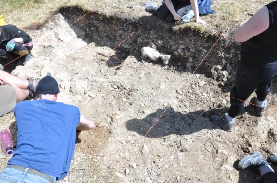
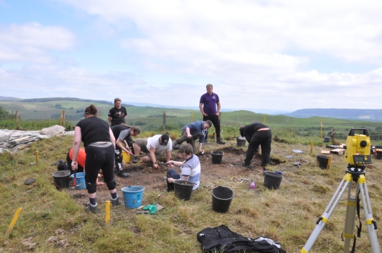
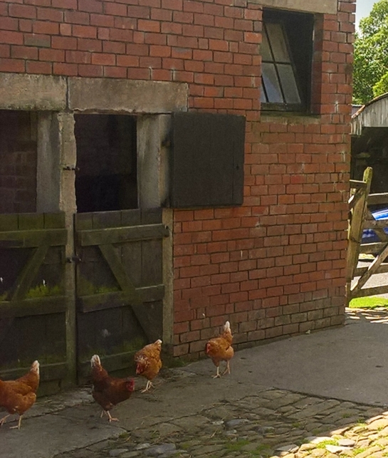
I was back out at Whitewell on Wednesday evening this week. Towards the end of this summer’s dig John and I had intended to put on a guided walk around the archaeological landscape of New Laund farm. This was for his friends, family and neighbours: many of whom were wondering what we were doing as we walked through their yards carrying strange tools, mysterious boxes and pausing only to make a fuss of their dogs and/or chickens. The idea was that we would all meet up a John’s house and then stroll around the landscape with me telling tales about the likely activities of the prehistoric inhabitants. However, the forecast for the evening we planned this in July was dreadful so we postponed it until this week.

John and Joe 2

On Wednesday morning, as the rain hammered down, I was beginning to think we would have been better to go with the original date. But, by the time I got out to Whitewell at six o’clock, it had turned into a beautiful evening. Because of the slightly shorter daylight available in late August we turned it into a 4×4 tour, with some of us riding in the back of the Land-Rover and others standing like motorised charioteers in the trailer of Joe’s quad bike. John and Joe are just parking here on the edge of the Middle Iron Age New Laund Enclosure, so that we can all appreciate the way the settlement  would have dominated the routeways along the Hodder valley.

IMG_20190828_190108

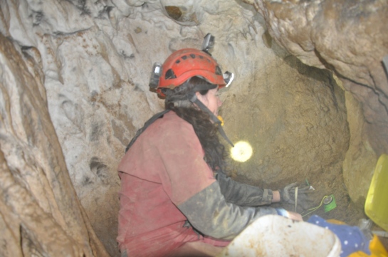
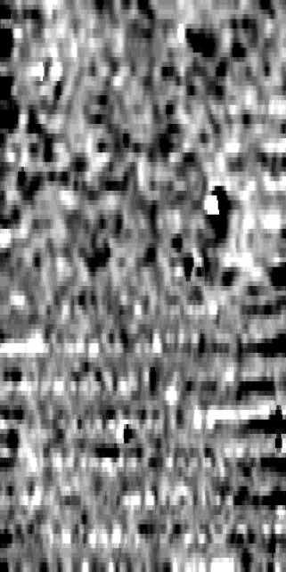
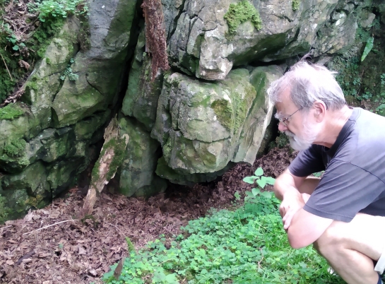
We looked down at the earlier Whitewell Enclosure from up on this vantage point too before heading up the hill to look at the area where we think we have discovered another Iron Age roundhouse, in the geophysical survey we did in July. Then, with the sun setting, we drove over to Dinkling Green Mine Cave to appreciate its sheltered south-facing aspect. Everyone agreed that, presuming that you had to live in a cave and chase down deer and aurochs for your tea, this was the cave you would choose.

Rick

A quick update on our excavation at Dunald Mill Hole in 2015. Josh worked on the juvenile Romano-British skull from this site for his undergraduate dissertation and was able to show that it probably came from a burial somewhere outside the cave and had been washed in during a flooding event. Di and Simon, the cavers who found the skull in the first place, and Jim and I, who supervised the dissertation, have all chipped in our contributions and the final report on the work was published this week in the journal Cave and Karst Science. I’ve added it to the reading list but all the salient points are in the abstract which I’ve reproduced below.

DSC_0042

Di excavating at the end of Pearl Passage, Dunald Mill Hole in 2015.

Abstract

A partial juvenile human cranium was discovered during exploration of Pearl Passage in Dunald Mill Hole in late 2014 by one of the authors (DA). Radiocarbon dating established that the individual died between AD 5 and AD 225. Further excavation of the deposits within the terminal chamber of the passage recovered a small assemblage of other fragments and some faunal remains. The human remains are likely to all belong to the same individual, aged between 3 and 6 years old at death, and to have been moved into the passage by flooding of the cave’s streamway. It is likely that the bones were eroded from further upstream rather than being deliberately deposited in the chamber where they were discovered.

Rick


I have repeatedly failed to sort out the time to update the blog over the last week. However, on the plus side, this does mean there is lots to write about now. First, an update on the gradiometer survey on the north side of New Laund Hill. This has proved harder than we anticipated to process satisfactorily. We had a great deal of dificulty getting the gradiometer set up properly in the first place as there was so much variabilty in the background. The first survey we did last week was extremely noisy once we downloaded it and didn’t show anything at all. We have subsequently had three more goes at it, with gradually increasing success.

NL19_mapView

This is that most recent survey after processing. North is at the top and the ditch features which John had pointed out to us are just outside the survey area to the east. It is still not ideal but I think I can see some circular arrangements of dark anomalies in the centre of the northern grid and a line of them running east to west just about where the two grids meet. It is all very speculative at the moment but they do look very similar to the circular feature in the centre of the New Laund Enclosure, which of course turned out to be an Iron Age roundhouse.

DSC_0120

Meanwhile, in the trench outside Dinkling Green Mine Cave we have successfully removed all the screes to expose the limestone bedrock over the whole area. Two things are now obvious. One, it is deeper than I had thought it would be. And two, there is evidence of quarrying or mining right down to the base of the trench. In particular there are three very clear drill holes for blasting charges.

DSC_0115

This is one of the ones in the main trench. Tony, Pete and Carol were back on site on Monday and Tuesday. They explored a lot more of the mine and discovered many more of these shot holes in every passage, even surprisingly deep underground. Beth also found a lot of small sherds of 18th century slipware at the north end of our trench, which gives a good idea of the general date of this mining.

The other thing that Carol, Tony and I did on Monday was explore some of the possible caves on the east bank of the Hodder. We followed a dry valley up the side of the main Hodder valley to look at three connected sites: Tip Wood; Whitewell Cave and Hell Hole. Tip Wood is a dry sink hole which is full of an implausibly vast amount of relatively modern junk (well there is a clue in the site name I suppose). There is no sign of either a cave or a rock shelter there now but I suppose if you could motivate yourself to shift all the corrugated asbestos, old freezers and plate glass you might get lucky.

img_20190715_141208.jpg

Whitewell Cave is relatively well known and has been explored by cavers without every producing any evidence of prehistoric occupation. It is the dark hole in the bottom right corner of this photo. However, what we are much more interested in is the long, low rockshelter which runs across the rock-face about one metre above the cave proper. This looks very similar to shelters in the Dales such as Sewell’s Cave, which did have prehistoric burials in them.

IMG_20190715_142505

This is Tony outside Hell Hole, which is smaller and more open and where the surface deposits at least look to be more recent. With these two sites, and the results of the geophysics, we are starting to get some  clear ideas about where we might do fieldwork in future.

Rick


An update from Tony on the conditions underground at Dinkling Green mine cave, after his and Pete’s exploration last week. He writes:

The lower entrance we explored had been worked quite extensively.  The slope from the top led to a small hole with a short drop into a high chamber which was actually a natural shaft going up and down.  It was probably 30 feet in total up and down.  To the right were very unstable  deads with a safer way down to the left which led to a very unstable mined area ending in a low choked phreatic arched tunnel with a shot hole to one side.   Just before this the bottom of the shaft was behind a very unstable barrier of wooden uprights and cross pieces holding back deads – black and rotten. Very dangerous and definitely not a place to ferret around.

Tony was back up on site yesterday, bringing Tom Lord with him, who I was delighted to meet again. He is one of the most knowledgeable people imaginable about Dales caves and their archaeology and geology and it was really useful to get his persepctive on our very different landscape.

DSC_0083

Outside the cave we have worked through a much greater depth of this scree, which is quite thick and very clayey (if that is even a word). We have found a few more pieces of worked stone in this layer as we have dug down through it towards the limestone bedrock beneath it.

DSC_0093

The other thing we have been working on today is exploring another possible Iron Age enclosure on the west side of New Laund Hill. This is another small ditch which John pointed out to us last year and so we have been using the Gradiometer to survey the plateau behind it for signs of settlement. Here Nick, Nathan and Pauline are getting to grips with the kit as Chris gives them the benefit of his previous experience. This morning I couldn’t find my non-magnetic tracksuit bottoms anywhere and the only trousers with no metal in them I could lay my hands on were my cricket whites. Strangely, standing at the end of survey lines in a surprisingly chilly wind and waiting for the surveyor to get to you feels just like fielding at long leg in the late overs of a mid-week 20 over game. It’s dark and cold and you rather hope the action is going to go on somewhere else but you feel duty-bound to clap your hands and make encouraging noises anyway.

Thanks to everyone’s hard work on what was some quite difficult ground we completed the whole plateau in four 30 x 30 metre grids. We will have a go at downloading these tomorrow and as soon as we have comprehensible results I will post them here.

Rick

We started Wednesday morning with most of the Dinkling Green mine site down to the same level. This seems to be the bottom of a silty scree layer which extended all over the platform outside the now destroyed cave mouth. It looks as if the original cave would have opened about where Lewis is standing and pointing in this photo.

DSC_0061

The first job on Wednesday morning was a thorough clean of this surface so we could photograph it before doing any more digging. Archaeological photos are best taken in nice neutral light, a cloudy day is ideal. Consequently, we spent a fair bit of the middle of the morning with everything set up for the photo anxiously waiting for very small clouds to move in front of the sun.

dsc_0065.jpg

They turned up eventually. Here is the silty scree layer in section. Once this was removed we have found that there was another scree beneath this. Again this is entirely typical of the natural deposits we should expect to find outside a cave and makes me think that the early modern mining and limestone quarrying hasn’t done as much damage to the original deposits as we feared it might.

DSC_0071

As you can see, we have reinstated all the grid squares and their reference lines. With this sort of scree deposit any finds need to be recorded in 3 dimensions and so by digging in controlled spits and sieving all the deposit as we remove it we should have the best possible understanding of any archaeology which is on the site.

While everyone else got on with the task of exposing and excavating the new scree deposit, I took Josh, Bethany and Pauline up onto the northern part of New Laund Hill with the total station. This is an area where John had shown me another ditch curving around the hill. This is very like the one we dug in 2012, which subsequently turned out to be part of a Middle Iron Age enclosure. Next week we plan to do some geophysics up here so we spent the latter part of this afternoon setting out some survey grid in the area we want to work on. We have never gone wrong following John’s hunches before, after all he drives all over this landscape all day everyday, so I am quietly optomistic about this new site too.

Maranda brought not one but two cakes to work with her today, including a particularly fine lemon drizzle cake, so we celebrated the 4th of July in style. Wildlife of the day was a weasel/stoat (I can never remember which ones have the black tips to their tails¹) sprinting down the road away from us as we drove home.

Rick

¹I’ve just Googled it, it was a stoat, thank you Woodland Trust


Tony, Carol and Pete from the caving club were back on site this morning to explore the underground passages. They were looking to understand which bits of the cave were natural features and which bits were dug out as part of the 18th and 19th century mining.

DSC_0051

Here they are gearing up to explore the lowest entrance, which is nearest to the part of the platform we are excavating. As you can also see, the baking hot weather of last Friday has given way to cloud and showers. The two higher entrances to the west of this one seem to be where most of the mining took place. There are drill holes from blasting visible in and around them and lots of carefully constructed drystone revetments inside to keep the shafts clear of rubble.

DSC_0057


This lowest entrance, however, seems never to have been part of the mine. According to Tony and Pete, who actually went down there, it slopes steeply downwards to the north. There is then a vertical pitch which leads into a large chamber, all of which appear to be natural passages. There is also another passage leading from this entrance to the south, back towards our excavation. Pete is belaying Tony as he explores that branch in the photo above.

There are other entrances dotted all around the cave, some of which both have a good depth of apparently undisturbed sediment in them and are also more accessible to non-cavers. We will hopefully be exploring some of these later on in the dig. On the main trench we have removed and sieved a lot more of the upper deposits and have come down onto what seems to be a new layer. We are going to try and clean up and photograph this interface tomorrow morning before we do any more digging.

A long-standing project tradition is at least one comedy stock-handling moment per year. We had the first of these for this season last night on our way off site. We had just crossed the last cattle grid on the track prior to joining Little Bowland Road when we discovered three sheep loose on the road. All we needed to to was encourage them to one side so we could drive past them but, of course, as soon as the van moved towards them, off they went in a nice straight line down the middle of the road. Thinking that the noise of the van was the problem, I got Lewis and Connor to get out and try and herd the sheep on foot. This, if anything, was worse. Lewis, Connor and the sheep all scampered away at a steady 4 mph right down the middle of the road with me trundling along behind them in the van as quietly as I could. After what felt like about a mile of this the sheep turned and ran full tilt at a bit of fence. As far as we could tell this bit of fence was indistinguishable from the fence they had been following for the last mile but they ran through it as if it wasn’t there and vanished off up the side of the hill.

Rick

Flaming June has arrived, at least for the moment. We are at just about 200 m above sea level at Dinkling Green, so we’ve had a nice cooling breeze to go with our few days of sunshine but it has still been quite hot enough. I know it is much hotter everywhere else in Europe but we burn easily up here.

DSC_0044

It’s hot and hard going, but look at the view.

On site we have removed a layer of extremely dense scree and found, beneath that, that there was a layer of very solid clay. Although we should be digging through an area that was part of the old calamine mine¹ so far all the deposits wouldn’t be unusual in an undisturbed scree outside a cave. It is fair to say that it has been fairly heavy going so far, we have been using the geology hammers a lot and sieving the sediments is hard work. However, from Wednesday onwards we have been finding occasional pieces of worked chert to encourage us in our belief that there was prehistoric activity in or around the cave. I got Nathan to wash these on Friday morning and they dried in about ten seconds in the heat so we were able to photograph some of the best bits to post here.

DSC_0047

This one I found in the sieve on Wednesday morning. Quite a big flake of very fine light grey chert.

DSC_0048

One of a pair of very large flakes of a similar grey chert which Eleanor found on Thursday afternoon. We are finding quite a lot of this grey chert on this site, which is interesting because on all the sites on New Laund Farm most of the chert was much blacker.

DSC_0050

Much like this piece of dark grey/black chert here. Hopefully, as we get further into the clay layer next week we will start to get more of these chert pieces.

Rick

¹Just typing the words ‘old calamine mine’ has set the Scooby Doo theme off in my head


We have started our fieldwork at Dinkling Green Mine Cave with many of the old favourites. There was a reprise of the ever-popular cattle/fence failure on Monday night. This year’s trench is inside an, admittedly quite venerable, barbed wire fence which we hoped would be enough to keep livestock and archaeology in two seperate places. As we left site on Monday night after a productive first day we were treated to the sight of frisky bullocks leaping over it in a ‘cow jumped over the moon’ style. This meant I spent the middle of Tuesday driving back to Preston to collect all the bits of the electric fence while everyone else cleaned up the mess in the rain.

DSC_0030

Chris admiring the neatly laid out grid squares on Monday afternoon before the bullocks got at them.

We’d had a bit of a slow start on Monday anyway. Normally I come out to site before a project starts with a couple of volunteers and we spend a day surveying and laying out the trenches so that the whole team doesn’t have to stand around watching two people arguing about who has done the maths wrong when the survey does go right first time. However, this year I decided that by doing that I was depriving everyone of a valuable learning experience by not letting them argue about who has done the maths wrong. This meant we all spent a happy morning setting and re-setting the total station before we got the trench in the right place about lunchtime. But hopefully everyone now has a much clearer idea about how you get from survey points in the GIS mapping to a trench in the right place on the ground.

DSC_0036

This was the trench this afternoon, taken from the top of the limestone outcrop that the cave sits in. As you can see we are well on with digging off the upper layers of the rubble and scree left by the mining. I am hoping that this will include evidence for what was in the cave mouth before it was mined away.

DSC_0041

The sun came out this afternoon too, reminding me to take some photos which show what an excellent view the cave would have had.

Tony and Carol from the caving club were also on site on Monday and we had an explore of the many current entrances to the cave system. Most of these are vertical shafts of varying degrees of scariness. Tony was involved in the original mapping of the cave and they are going to come back later on in the project with a team and explore these further.

Hares continue to be the wildlife we see most of. There were a pair of males boxing in the pasture below us on Monday afternoon. However, wildlife of the day on Tuesday was a mole, swimming along in the long grass on New Laund Hill when we went for a tour of the previous excavations. I didn’t realise that they moved above ground like this.

Rick

It is getting very close to the start of the fieldwork at Dinkling Green Mine Cave. The other Uclan projects on Anglesey, Ribchester and out in California are already going full tilt and now it is our turn. I have spent most of this week sorting out all the equipment we need, and, in some cases, buying more. Hard hats, it turns out, go out of date. Who knew? Well me, if I thought about it. Also if I thought about it I would have realised that helmets I bought in 2005 to work at Goldsland might be approaching the end of their working life. Anyway, I digress. With a lot of help from Eleanor, I have turned out the stores and packed up all the kit we needed.

WP_20190620_12_24_56_Pro

Today we drove up to Whitewell to load a lot of it into the farm buildings we are going to be using as a toolshed. We are working in a different part of the landscape so we have moved from the old shed on New Laund Farm. It looks like we are going to be disputing the tenency of this new one with the hens. I had meant to ring John this morning to check that today was a good day to bring all the gear out. However, I had a minor computer glich this morning which meant that I ended up spending a lot of the early morning on the phone to Leica customer support. This meant I missed the time when I can normally be sure of contacting someone at the farm, while they are having their mid-morning break and the rest of us are just about thinking about starting work. We headed up there anyway and caught Daniel in the middle of shearing many sheep, so we went round the back way and tried to keep out of the way.

DSC_2978

Once the tools were safely stored we headed up to site to see how overgrown it had become since my last visit in May. Generally not too bad, although there are a few more nettles than there were. Just as we were walking up to site a big male hare sprinted across the track in front of us and headed off up the hill to be the wildlife of the day.

Rick


The other exciting thing that happened last week was that actual physical copies of my cave burials book, which was officially published on Easter Monday, turned up in the office. Manchester University Press have done a really good job with it and I’m very pleased with how it looks. Even more importantly, despite the fact that it took me a long time to write, I am really happy with how it reads. Normally, once I’ve written and published something, I start to see glaring holes in the arguments I made. This time, so far so good. To celebrate the publication I did a guest post for the MUP blog, which I’ve re-posted here.