It Fits…
…where it touches. This week I have trying to push on with writing up the work we did at Moseley Height, outside Burnley. I’ve blogged before about this site. It was an Early Bronze Age ring cairn which was salvaged in advance of NCB open cast mining in 1950 by Walter Bennett of the Burnley Historical Society. We went back in 2010 to see what survived on the site. Thanks to the generosity of Mike at the Towneley Hall Museum in Burnley we’ve also got access to the orignal finds and records from the 1950 excavations. This is where the urn with the possible human bone tempering came from that I blogged about in January.
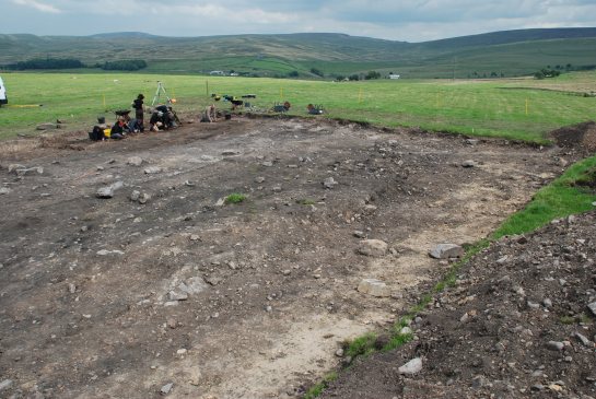
This is what we found. We stripped a 20 by 30 m area in roughly the right place down to the level of the subsoil. This showed us the edge of the NCB’s open cast pit (the area of pale subsoil visible along the front edge of the trench) and also a lot of battered looking stones in more or less the place we were expecting to find the ring cairn.
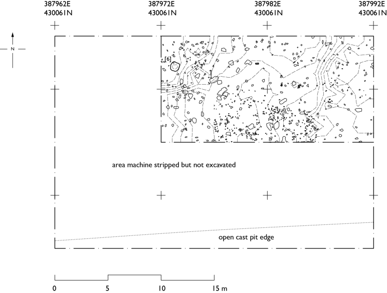
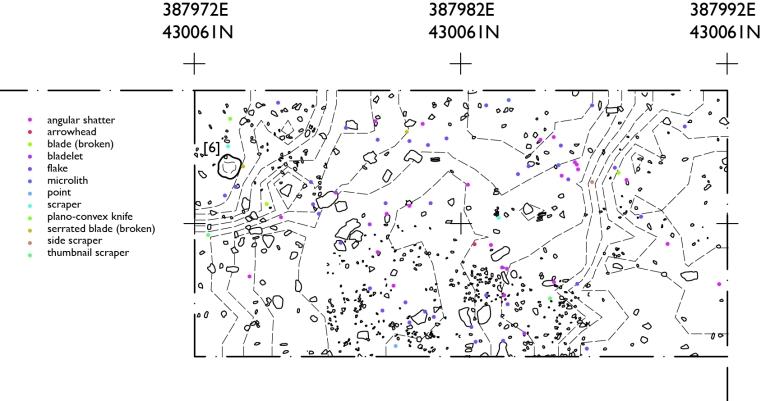
We focused our detailed digging in the area around the cairn. The dotted lines are contours at 0.1 m intervals and you can also see lots of surviving stone and rubble from the cairn. Feature [6], the very shallow base of either a pit or a stonehole, was the only archaeological feature that survived.
So, it was there, but it is now gone. The contours still show a vague circular shape in plan, with a dent in the middle where Bennett’s main trench was, but very little of the actual monument survives. However, what we did find was a lot of very nice worked stone, both chert and flint.
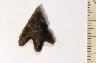
This is a barbed and tanged arrowhead that Magda found on the last real day of digging. Nice to look at but also nice because these are very securely dated to the Early Bronze Age; it belongs with the ring cairn. There were also a lot of Early Bronze Age scrapers and flakes. Ross, who studied all this worked stone for his BSc dissertation, found out some surprising things about some of the other worked stone.
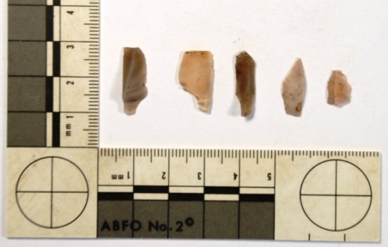
These are bladelets (small blades) and two microliths, all of which ought to be about 3000 years older than the ring cairn. There was obviously a much longer history to this site than the Early Bronze Age burials. Long term activity at sites always fires the synapse in my brain that is marked ‘archaeology of memory’ (see what a good grasp I have of neuroscience). This in turn led me to thinking what else was there from Moseley Height that was earlier than the Early Bronze Age.
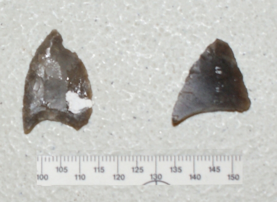
When we looked at the collections in Towneley Hall then I found things like this. These two are either oblique or hollow-based arrowheads, either way they are Late Neolithic. This is actually much better evidence for meaningful group memory, they are likely to be generations older than the ring cairn, rather than millennia. We can realistically imagine that the people who built the ring cairn had some broadly accurate traditions about who the people who left these arrowheads were.
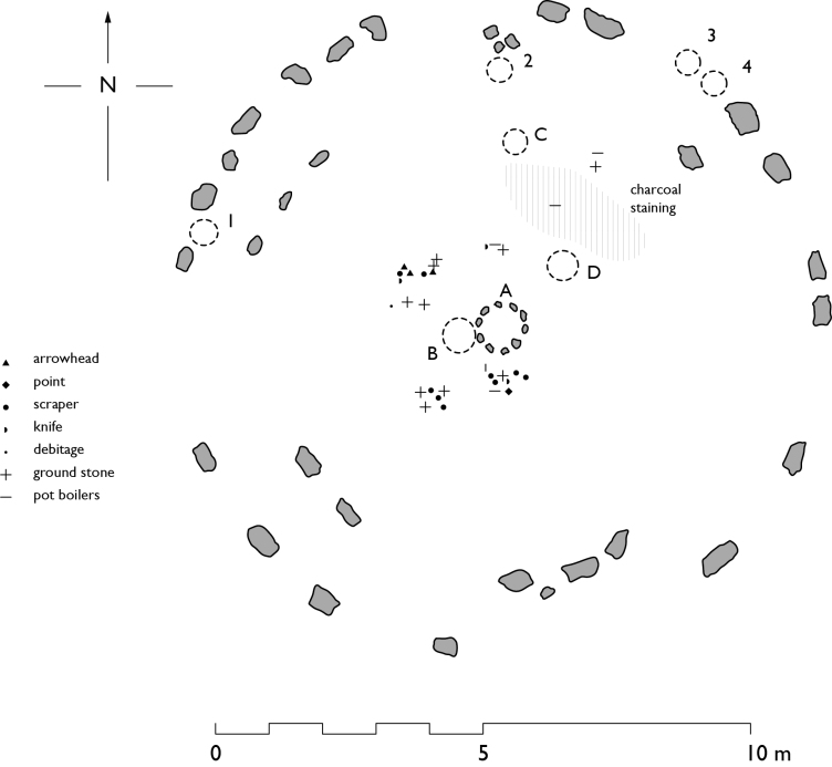
Even more usefully, Bennett left a field drawing in the archive which shows where all his small finds came from. This is my digitized version of that plan. What is particularly interesting is that all the datable finds from the cluster to the north-west of the central pit are Late Neolithic, so this may mark the position of an early deposit right at the beginning of the use of the cairn. Sam, in her dating programme for human bone from Early Bronze Age sites, found that the first burial at Hindlow Cairn in Derbyshire was a Late Neolithic cremation.
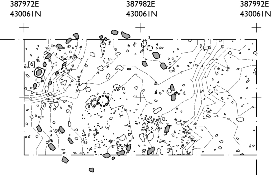
Of course, we’ve also got details of where all our finds cames from, although I am not so far on yet with splitting these up by date. What we really need to do is fit the two distributions together. This is a hard job because the only real points of contact between are two sets of records are 1) we know which way north is 2) the feature we dug as pit [6] is presumably a stonehole or pit base. Given where it is, it ought to be one of the stones on the north-west side of the outer cairn. This allows us to overlay the 1950 plan onto ours with a margin of error of about 2 metres, depending on which precise stone we think went in pit [6].
This is my current best guess as to where the ring cairn used to be. Now I have got all these lovely pictures, I really need to get on and write some words to go with them.
Rick

great post !!!